
|
Text by Jeff Barringer |
 click to enlarge |
|
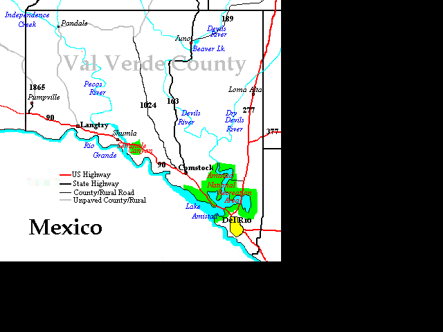
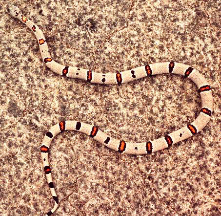
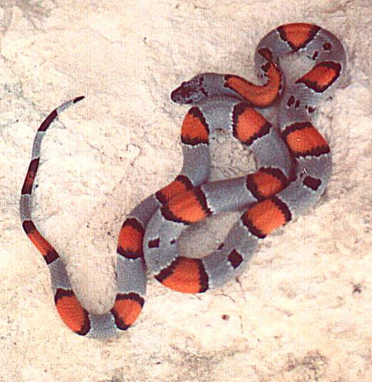
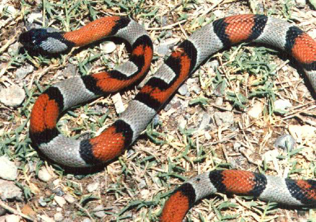
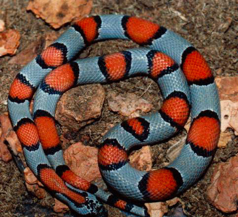
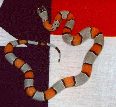
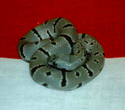
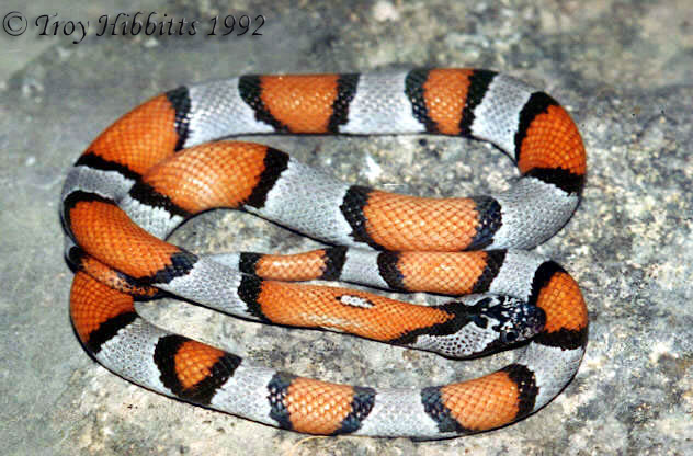
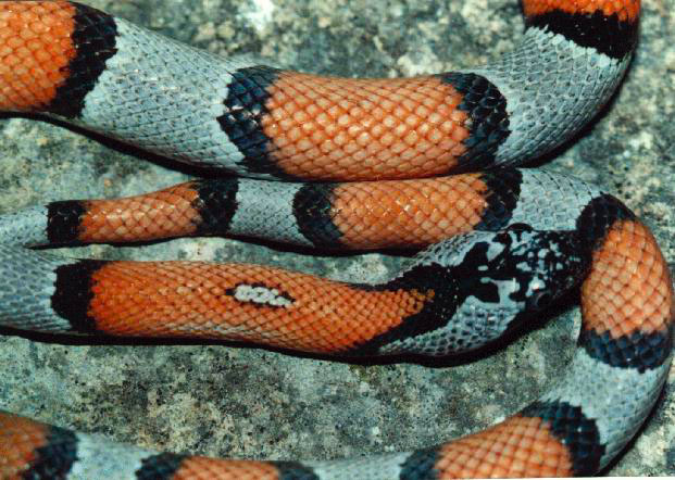
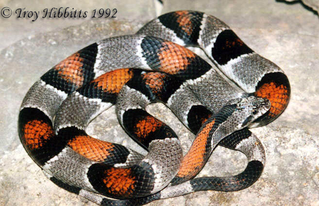
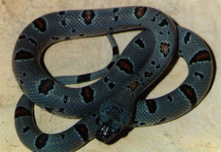
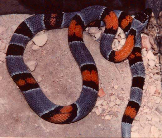
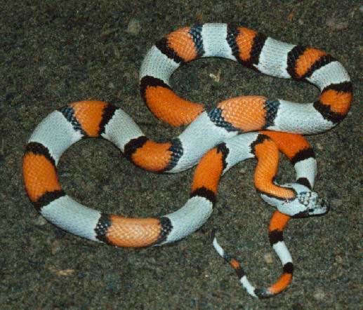
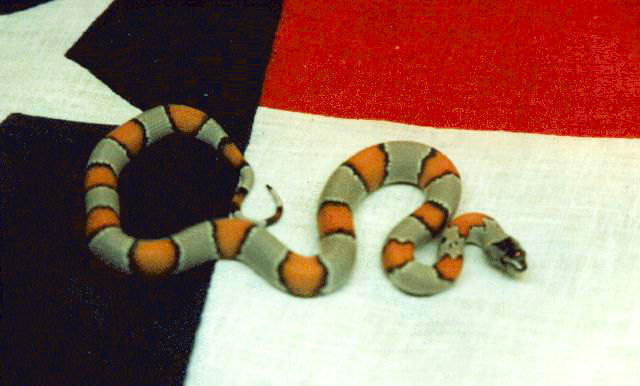
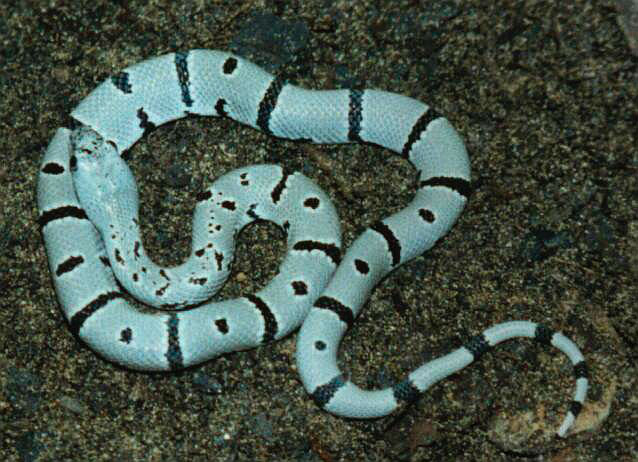
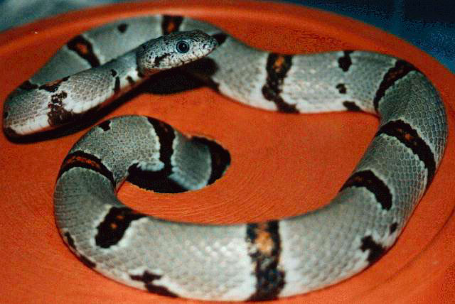
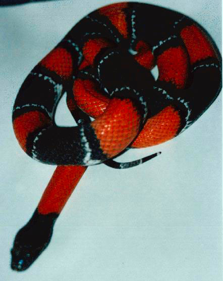
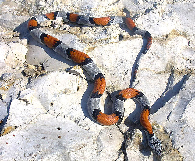
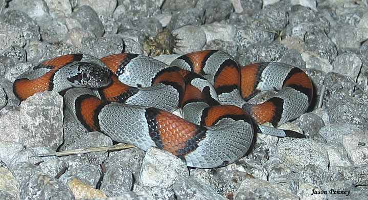
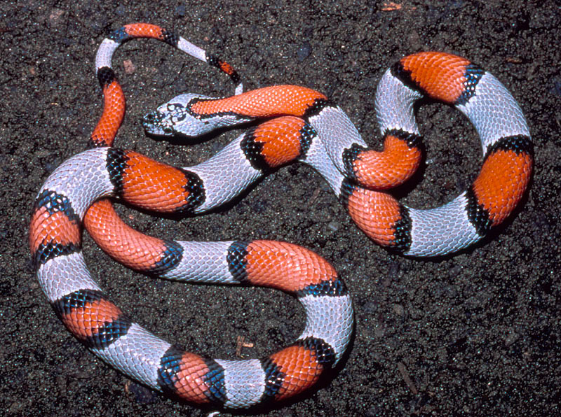
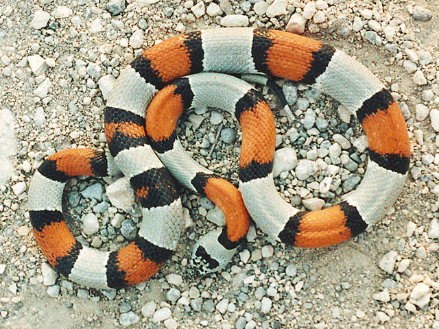
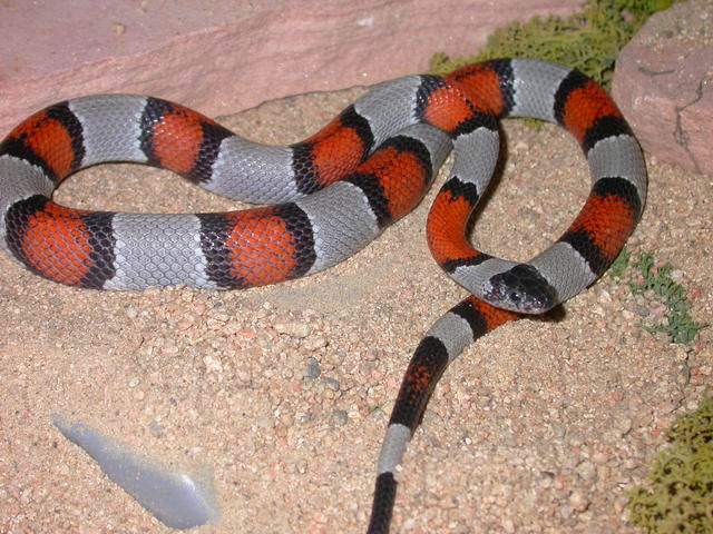
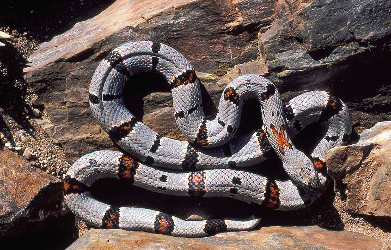
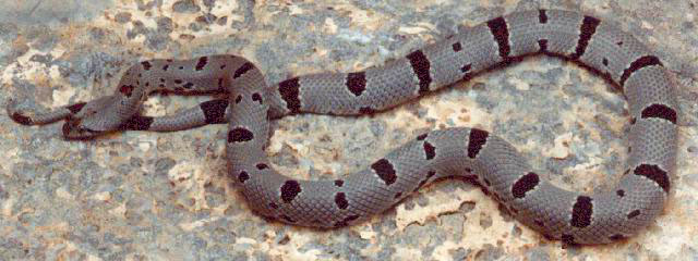
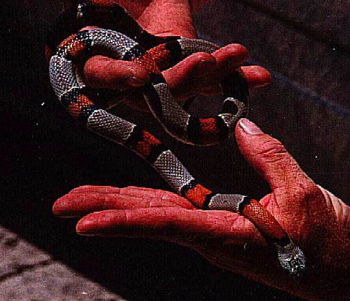
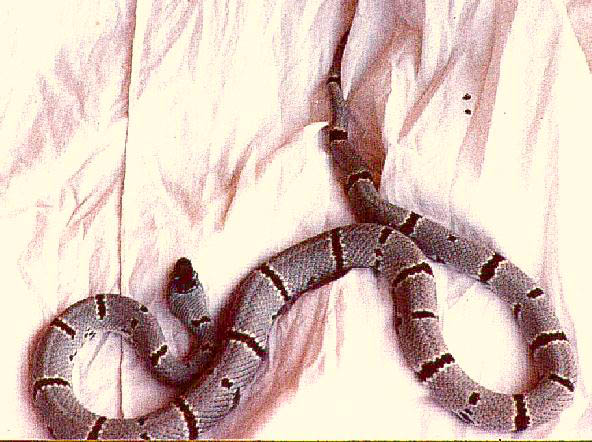
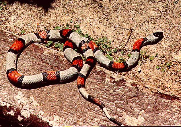
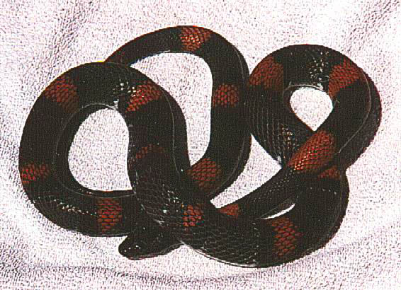
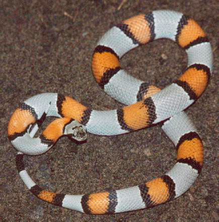
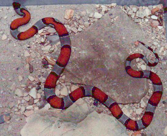
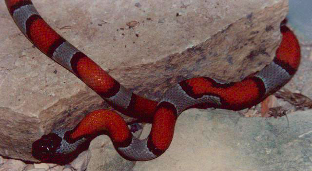
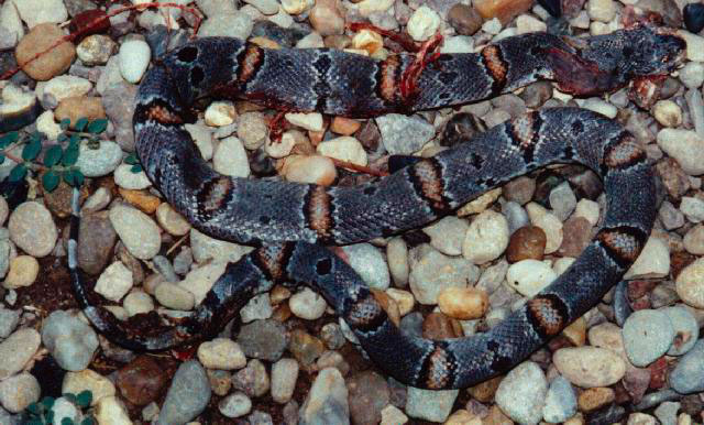
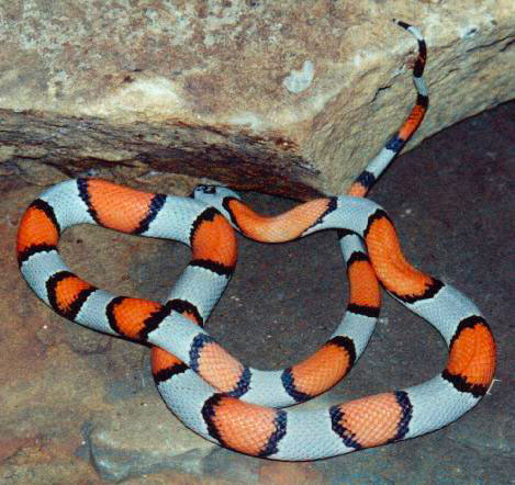
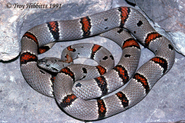
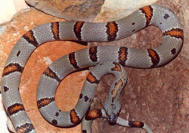
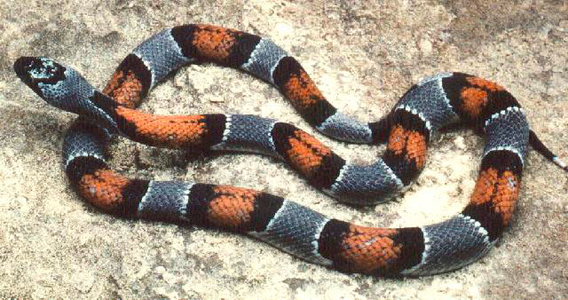
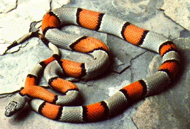
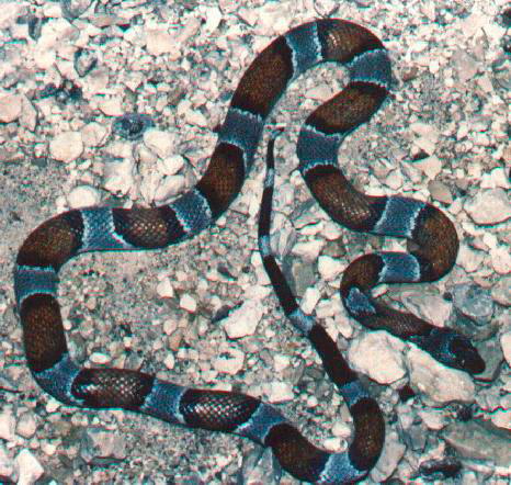
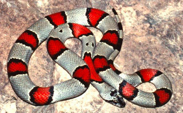
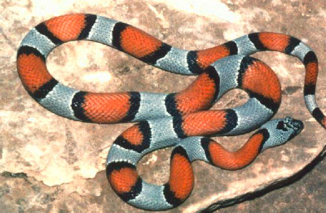
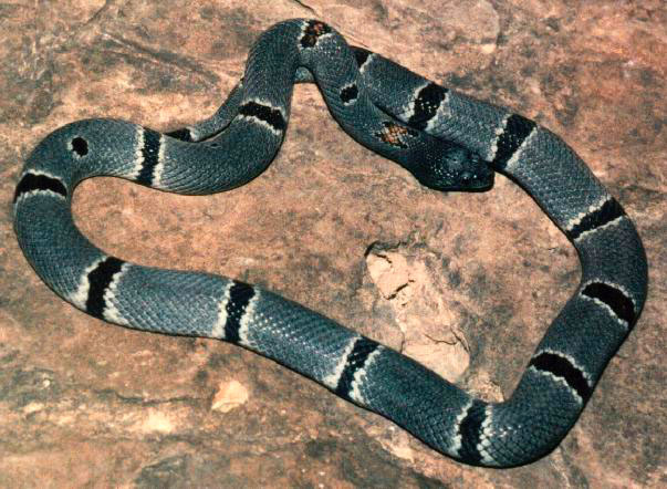
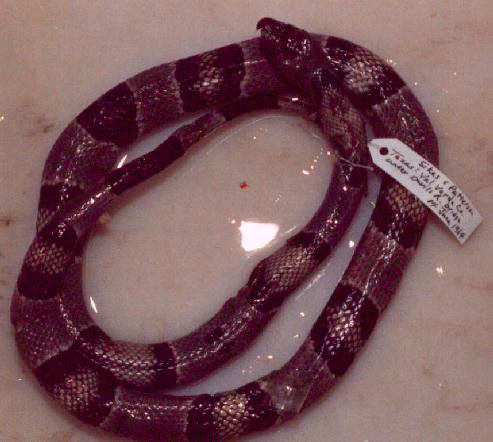
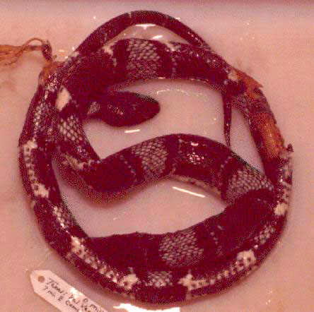
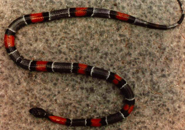
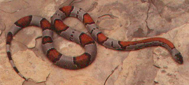
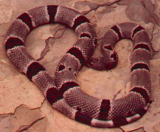
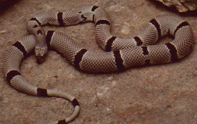
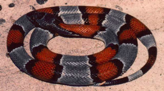
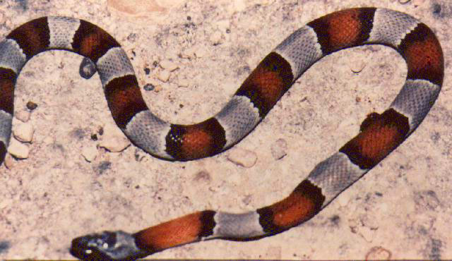
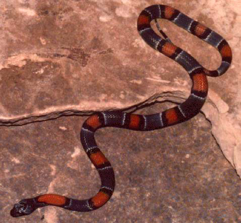
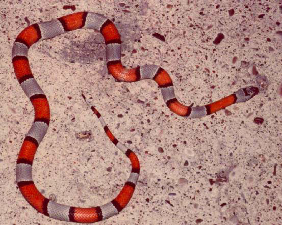
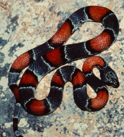
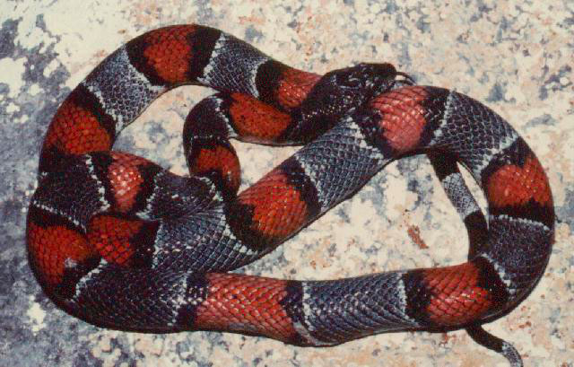
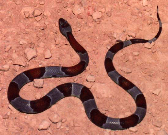
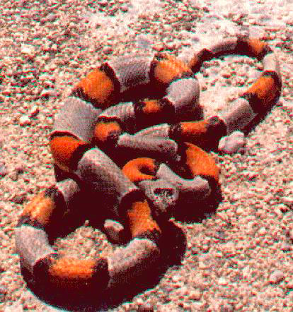
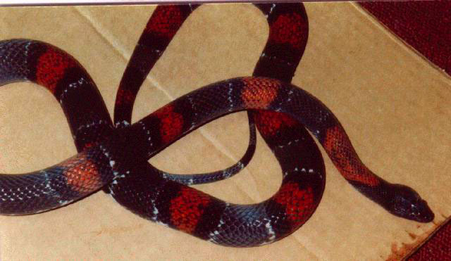
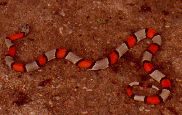
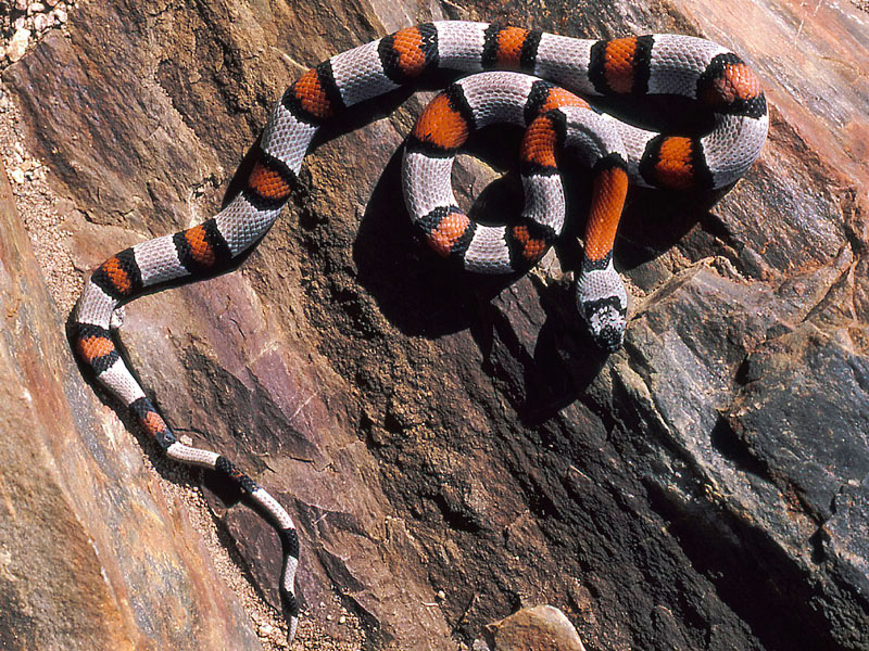
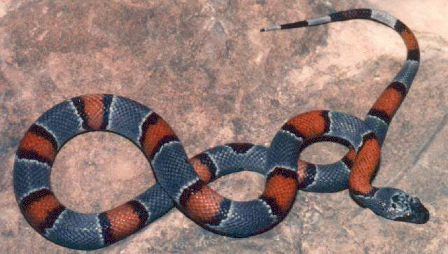
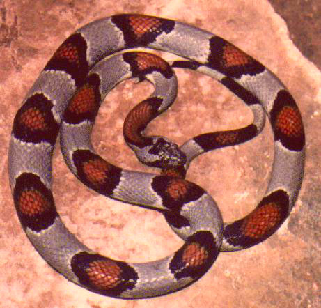
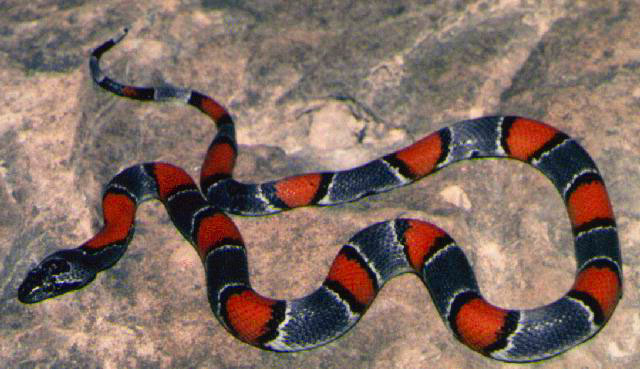
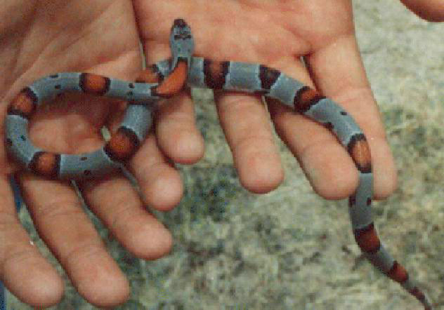
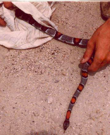
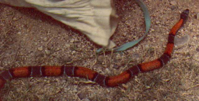
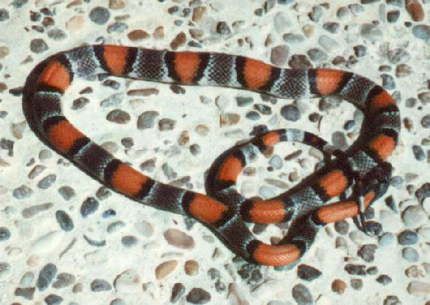
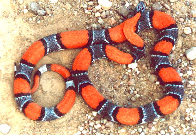
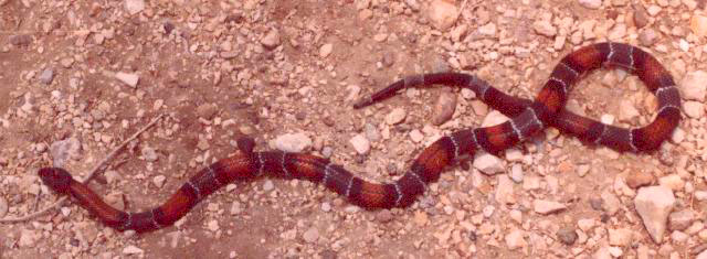
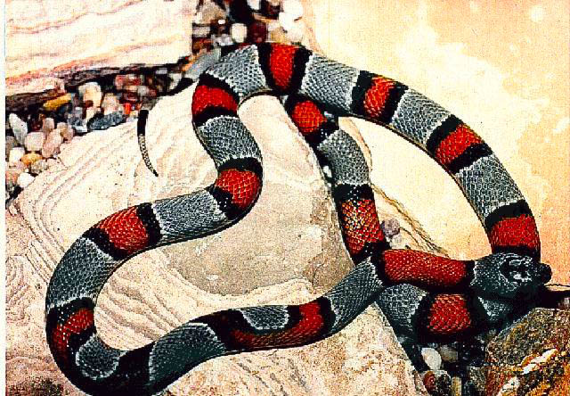
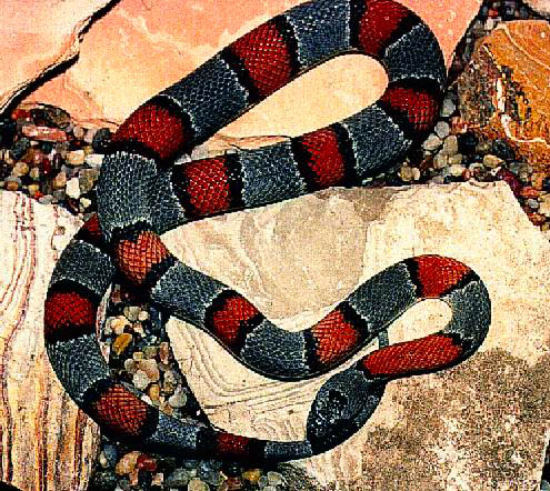
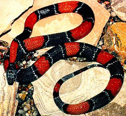
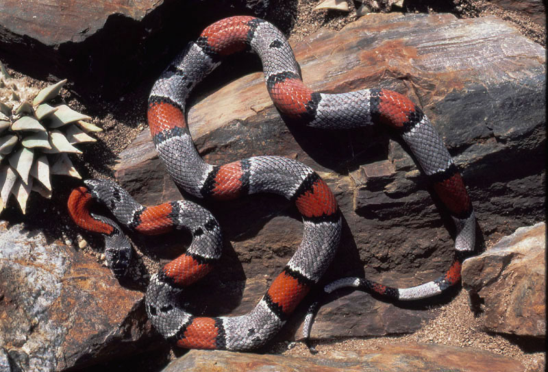
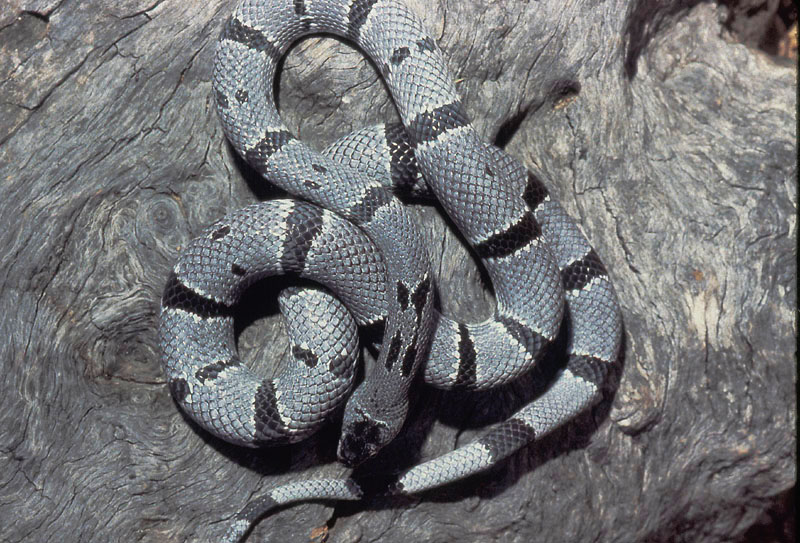
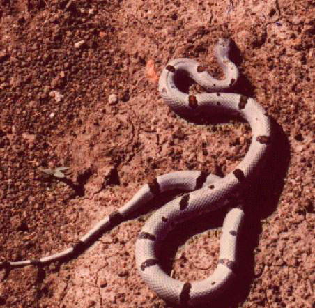
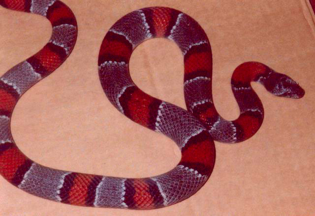
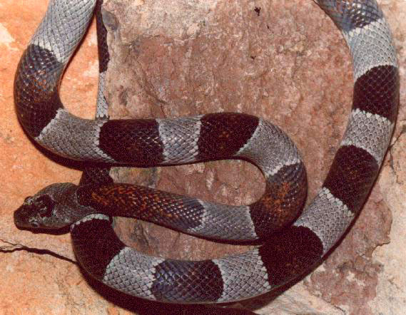
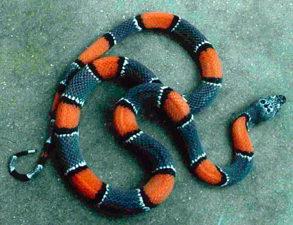
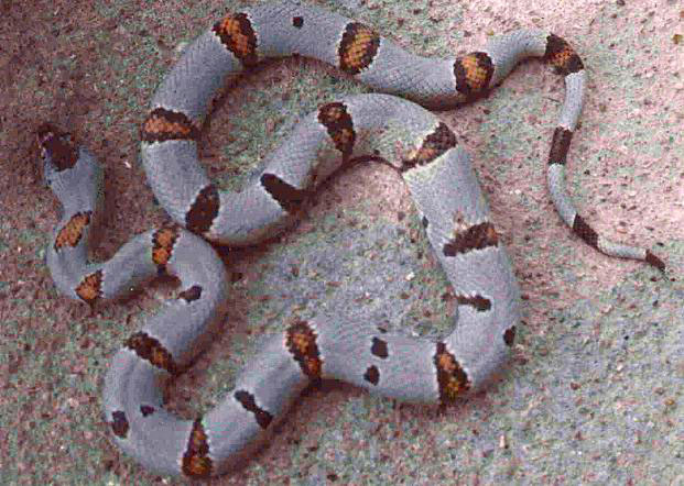
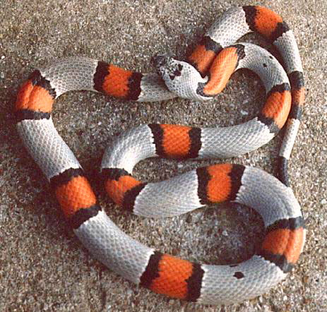
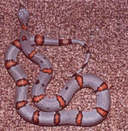
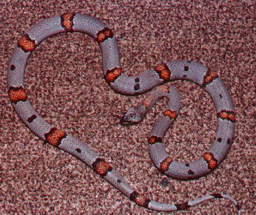
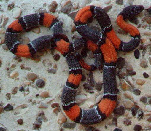
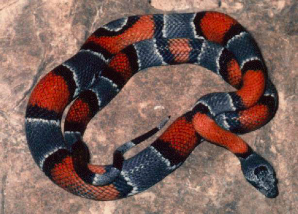
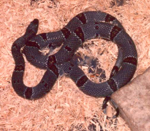
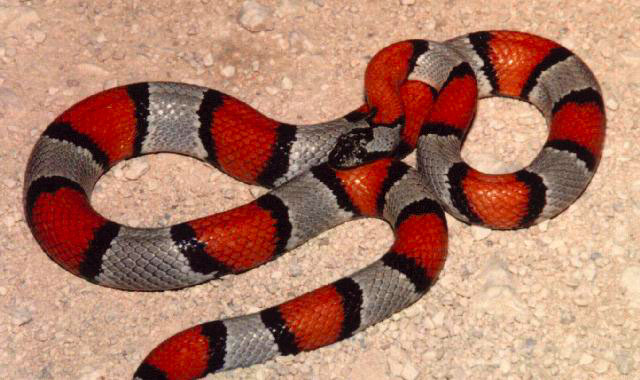
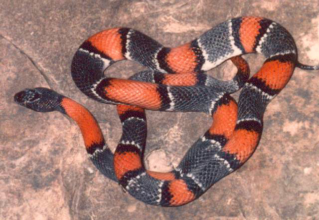
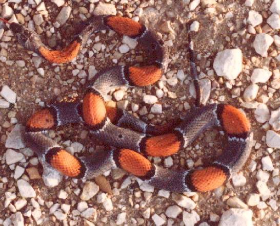
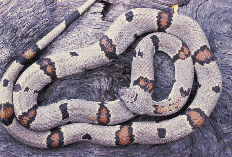
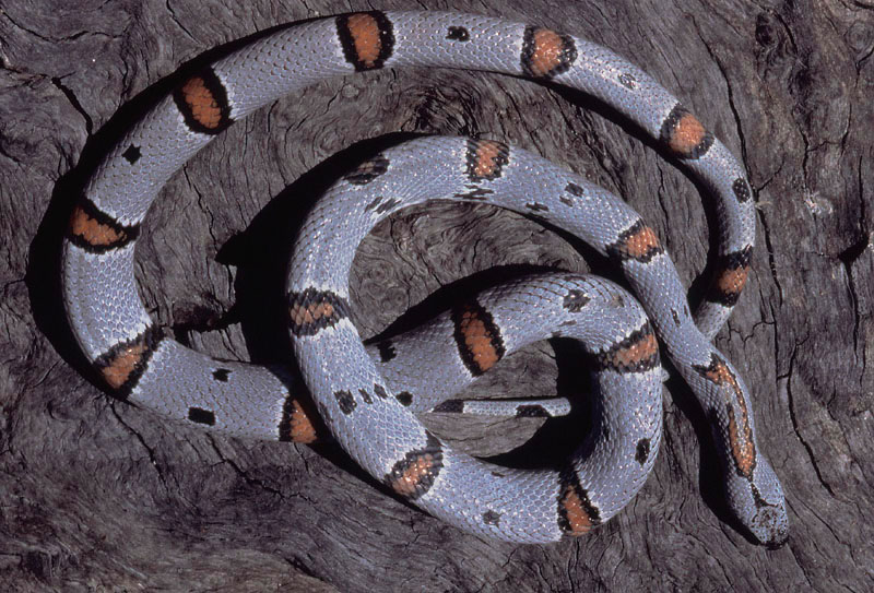
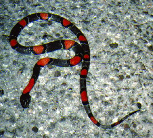
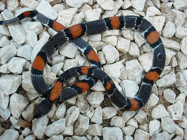
PHYSICAL GEOGRAPHY Val Verde is a rural county consisting of 3,241 square miles of territory, most of it consisting of rough hilly chihuahuan desert, with numerous canyons, draws, washes and gullies. Val Verde county is considered to be the easternmost part of the Chihuahuan Desert in Texas. It is also considered to be the eastern border of whats known as the Trans-Pecos region of Texas Vegetation consists of a riparian, thornscrub variety, with many varities of succulents and cacti such as sotol and lechugilla, and prarie type grammas grasses. Trees and shrubs tend to consist of creosote and mesquite although in some areas live oak and pinion occur as well. Major highways include US 90, running horizontally along the southern portion of the county, paralleling the Rio Grande along counties southern border, west of Del Rio. State Highway 277 runs vertically from Del Rio towards Sonora in the eastern part of the county. Running vertically from the town of Comstock is TX163 that leads thru the town of Juno up to IH10. Just outside of Juno is CR1024 that leads to the hamlet of Pandale. The county also contains many rivers (Pecos, Devils, Dry Devils), creeks (Carruthers, Buffalo, etc.), and springs (Carrizzo)that empty into the Rio Grande, which in turn empties into the Lake Amistad (Friendship) International Reservoir just west of Del Rio. CLIMATE Rainfall in the county averages 17.20 inches per year compared to the Texas average of 21.0 inches per year. The rainy season tends to occur in late May, early June, with rainfall tapering offtowards the end of June. This seasonal rainfall contributes the largest percentage to the years annual rainfall. During this period severe storms usually sweep from West to East, often bringing high winds, damaging hail, and tornadic activity. The potential for multi inch-rainfall makes flash flooding a dangerously common possibilty in May/June. The average growing season in Val Verde county is 300 days with the average first freeze generally occurring around Dec 9. Temperatures tend to range from mild to hot, with 60 degree lows in April, 70 degree lows in May and 80 degree lows in June. POPULATION The county of Val Verde, is the 68th largest of the 254 counties in Texas; with an estimated population of 40,022 in 1991 with a population density 10.60 residents per square mile. The average density in Texas is 65.6 persons per square mile. The county seat of Val Verde is Del Rio. Del Rio is considerably larger than any other city/town. The second largest is the town of Comstock to the west and the Langtry, home of the famous Jersy Lilly Saloon and Judge Roy Bean. Val Verde county also hosts the Lake Amistad National Recreation Area, Seminole Canyon State Park, and Dolan Falls State Natural Area. Del Rio also has Laughlin Air Force Base, a secondary flight training facility. Del Rio is also a major international border crossing with Acuna, Mexico, directly across the bridge over the Rio Grande. POPULAR L.alterna LOCALITIES L. alterna are found throughout Val Verde County. Val Verde was once considered the easternmost part of L.alterna's range, but further collecting has shown that this is not the case. More L.alterna have been collected in Val Verde county than all other counties combined, partly because of access and partly because of the variety of water resources, not found in the western counties. The predominant color/pattern for the county appears to be the wide saddled Blairi form, with dark grey background more prevalent in the west and light grey in the east, although both Juno and Loma Alta areas have their share of the Alterna form as well. These animals tend to be of a more "clean" pattern than the western varietys, meaning no or few speckles or alternates. Juno Rd (TX 163) Habitat Specimens Loma Alta (US 277) Habitat Specimens Langtry (US 90) US 90 - Del Rio to Comstock Specimens
US 90 - Comstock to Langtry Habitat Specimens US 90 - Langtry to Pumpville Habitat Specimens Pandale Dirt Habitat Specimens Pandale Paved (FM 1024) Habitat Specimens
|
