
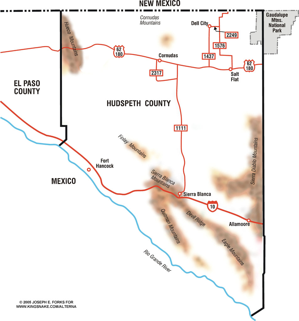
Map by Joseph E. Forks |
|
|
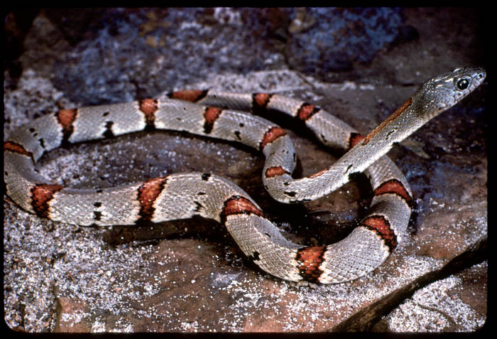
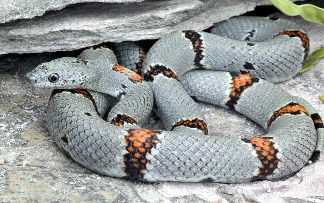
Physical Geography Hudspeth County is a large county (4,554 square miles) which lies just to the west of Culberson County. It is one of two counties in Texas which lies in the Mountain Time Zone. Geologically, Hudspeth is very diverse, with Cretaceous Rocks of a variety of types distributed widely throughout the county, Tertiary Volcanic intrusions widely scattered locations (these deposits are nowhere near as abundant as they are to the south in Jeff Davis, Presidio, and Brewster Counties), Permian Limestones, and other rock formations origninating from various other Paleozoic Eras. In addition, along the Rio Grande River, lies a large expanse of Quaternary sediments. Mountain ranges include the Hueco, Finlay, Quitman, Eagle, and Sierra Diablo, however, most of these mountains lie on private land, well away from public access. ClimateHudspeth County is very dry, averaging only 8 inches of rainfall per year, well below the Texas Average, and low enough to consider it a true desert. Plant life includes a variety of desert grasses, shrubs (including mesquite, acacia, and creosote), and cacti. In places, lechugilla, sotol, and yucca are common. Population Hudspeth County is rather sparsely populated, with only 2,879 people, most of whom live in either Sierra Blanca or Dell City. The only other town is Allamore. Very few Lampropeltis alterna have been collected in Hudspeth County, with two (verified) from the Hueco Mountains, and one collected on private land in the Eagle Mountains. Additionally, a small number of snakes are rumored to have been collected in the Quitman Mountains near Sierra Blanca. Very likely, the total number of Gray-banded Kingsnakes collected from the county is less than ten snakes, probably fewer. Possible Collecting Localities
US 62/180 where it passes through the Hueco Mountains
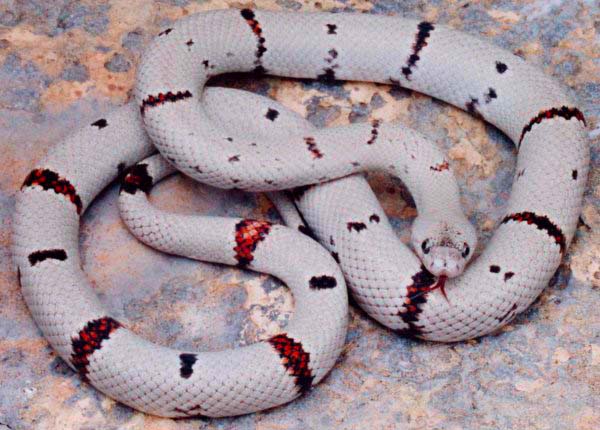
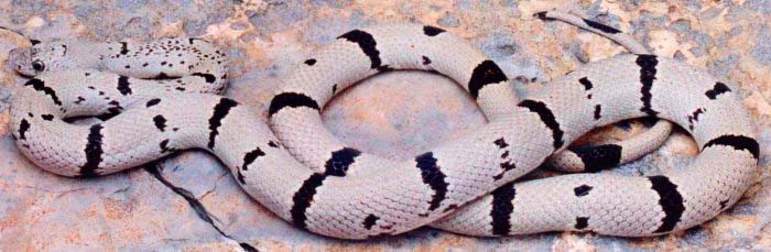
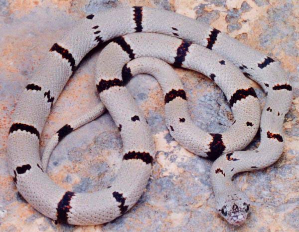
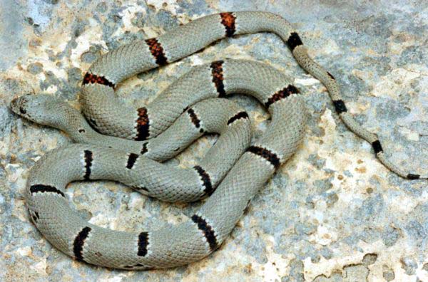
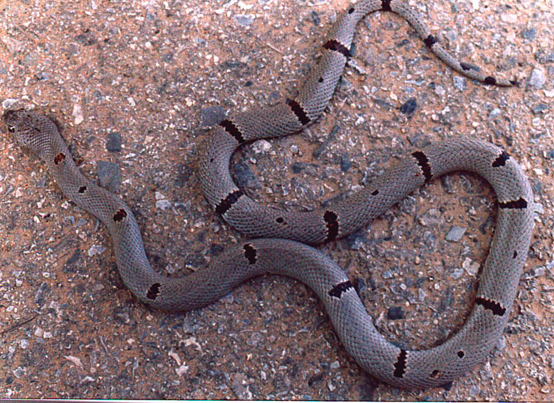
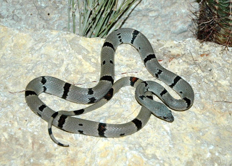
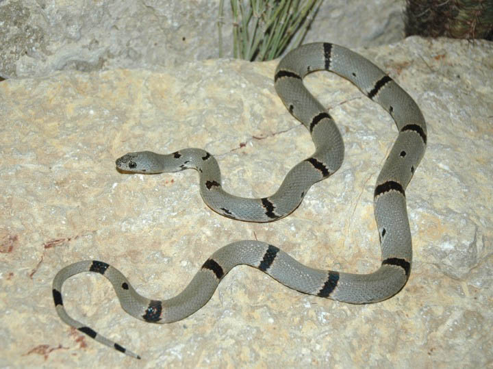
Specimens
Rock formations here are mixed sedimentary, metamorphic, and igneous rocks of Cambrian age. Collecting along the actual interstate is not recommended, although the wide right-of-way could be walked to produce an alterna. Interstate 10, just west of Sierra Blanca Rock formations here are predominately Tertiary igneous intrusives. Again, collecting along the highway is not recommended, although the right-of-way could be collected. Additionally, there is a roadside picnic area here which features large igneous boulders. Indian Hot Springs Road, south of Sierra Blanca (4-Wheel Drive only, weather permitting) Approximately 20 miles south of Sierra Blanca is an old cavalry outpost and later a resort which has since been abandoned (or nearly so). In this area exists some habitat which is collectible, give dry weather conditions. In wet weather, the road can be unpassable. Note, this makes collecting for L. alterna problematical, as the kingsnakes move only when weather conditions are moist. |
